Article successfully added.
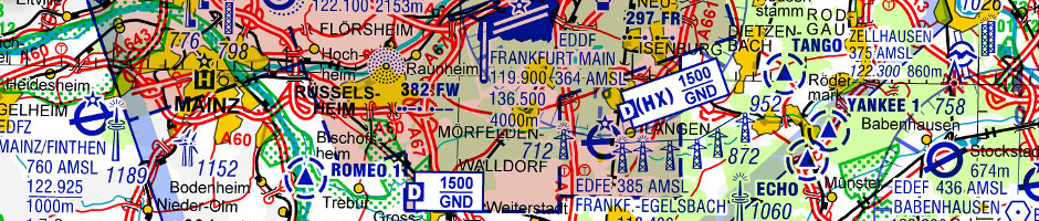
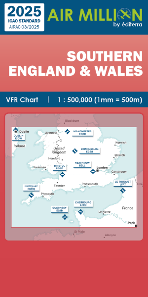
AIR MILLION: VFR-Zoom-Chart Southern England & Wales 1:500.000 (edition 2025)
(Order No.: S1211003-25)
")
")
")


HIGHLIGHT
NEW
, Motorflug")
HIGHLIGHT
NEW
, Motorflug")
HIGHLIGHT
NEW
, Motorflug")
HIGHLIGHT
NEW
, Motorflug")
HIGHLIGHT
NEW
, Motorflug")
HIGHLIGHT
NEW
, Motorflug")
HIGHLIGHT
NEW
, Motorflug")
HIGHLIGHT
NEW
, Motorflug")
NEW
")
NEW
-preorder")
NEW
NEW
NEW
NEW
 Preorder")
NEW
")
NEW
, Nachttiefflugstrecken")
HIGHLIGHT
 (preorder)")
HIGHLIGHT

NEW
NEW
NEW
NEW
NEW
NEW
NEW
 - Preorder")
NEW
- Preorder")
NEW
- proorder")
NEW
")
HIGHLIGHT
NEW

HIGHLIGHT
NEW

NEW
HIGHLIGHT
NEW
 (preorder)")
HIGHLIGHT
")
HIGHLIGHT
 9/10 IFR route chart Europe - lower airspace")

Eisenschmidt Spring Deal


HIGHLIGHT

HIGHLIGHT

HIGHLIGHT

HIGHLIGHT
NEW
HIGHLIGHT
NEW
HIGHLIGHT
NEW
HIGHLIGHT
NEW
HIGHLIGHT
NEW
NEW
HIGHLIGHT
NEW
HIGHLIGHT
NEW
HIGHLIGHT
NEW
NEW
NEW
NEW
NEW
NEW
NEW
HIGHLIGHT
HIGHLIGHT
NEW
Viewed