Graduated prices (ifos: V500)
You already have0articles of this price group in your cart.
| Quantity | Unit price |
|---|---|
| To 19 | €24.00 * |
| From 20 | €21.60 * |
| From 50 | €19.20 * |
Prices incl. VAT plus shipping costs
Ready for shipment: Delivery within 1-3 workdays
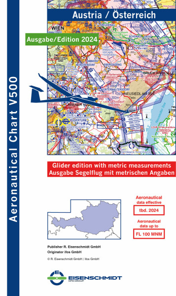
Edition 2024, Austria Glider: The aeronautical chart V500 Glider is the first aeronautical chart for gliders that corresponds in quality and design to the German ICAO glider chart 1:500,000. The V500 Glider is published with metric data and offers more safety and flexibility abroad with its clear topography display and up-to-date air traffic control information. It covers the territory of Austria including neighbouring countries and consists of one map sheet.
The V500 contains the latest and currently valid topography and air traffic control information such as
VFR reporting points
aerodromes with name, place name and frequency as well as length and orientation of the runway and location of the traffic circuit
Information on the aerodrome circuit, display of aerodrome heights
FIS sectors with frequencies
Gliding areas, hang gliders and microlight aircraft areas, parachute jump areas and balloon launch sites
radio navigation equipment (NDB, VOR, VOR/DME, VORTAC) with name, frequency and Morse code identification
Aviation Obstacles and Maximum Elevation Figures
Isogons
Motorway designations
Integrated coordinate ruler
The back of the card displays the following information:
ATIS and VOLMET frequencies
Semi-circular flight altitudes VFR and VFR remote control
Information on the altimeter setting
Light signals
| Ausgabe / Auflage / Jahr: | 2024 |
| Manufacturer / Publisher: | R. Eisenschmidt GmbH |
| Country / Continent: | Austria |
| Material: | Paper |
| Sport: | Glider |


